South by West- camping from Alaska to Nicaragua
2-Arches Park and beyond
Camping with buffalo; Mormon Mecca; Dead horse NP; Arches NP; Showers in Moab; Hiking Grand Canyon; Hot Arizona; Veterans Day parade; In Mexico;
--------------------------------------------------------------
We are in Utah: The First night we camped on Antelope Island on the Great Salt Lake. The lake is huge, almost as big as Georgian Bay. Water as expected was very salty but too cold to swim. There was a herd of buffalo grazing around our campground. I couldn't find firewood so I gathered dry buffalo chips [shit] and used it to make fire the old fashion way, like the pioneers. It made hot, smokeless fire.
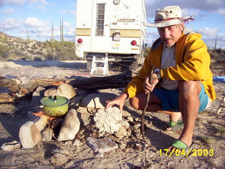
....Cooking with Buffalo chips....
Salt Lake City is located in flat country, surrounded by mountains. It was probably a beautiful city some 30- 50 years ago but now it is an urban sprawl 80 km long. Brigham Young must be turning in his grave to see the fertile farmland his pioneers worked so hard to create, being paved over and turned into subdivisions. The core of the city is Temple Square, the Mecca of the Mormon Church. It has Visitors Center, museums, library, concert hall and a big church. Unforgettable was the Mormon Tabernacle Choir we saw on Sunday morning in live broadcast. Everything was free! We stayed overnight in a big parking lot close to the Temple Square for $2.
Next day we drove up the Emigration Canyon where according to legend Mormon immigrants, after back breaking journey, first saw the Great Salt Lake and their Promised Land. It was a big disappointment for us. We didn't see the lake and the Canyon is now full of houses with some very exclusive, gated super mansions.
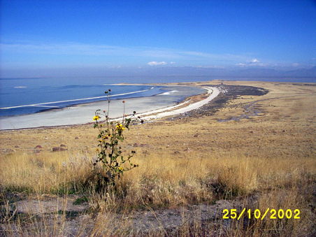
...Great Salt Lake. The white beach is evaporated salt...
There are so many state parks in Utah and it was difficult to choose where to go. We picked the Dead Horse Point State Park. The road was very scenic with high, red, stratified cliffs on one side of the highway, mile after mile. Then we were in flat, dry, open country and after long time, came to an endless wall of bluffs.
We stopped at a view point and nearby was a car with three teenagers, four high power rifles spread on the hood, blasting away at bottles and cans.
Then came the turn off to Dead Horse and we were driving in a canyon with spectacular red towers and cliffs. The steep road was winding up and up to 6000'. Suddenly we were on a flat, featureless plain and the canyon disappeared behind us, as if it never existed. Fifteen more miles on this plateau and we were at the Dead Horse Point State Park.
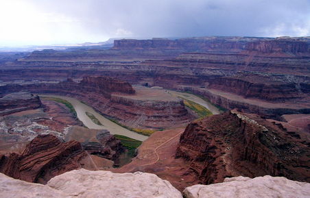
...Dead Horse Point where the Green River meets the Colorado River...
At this point the Green River joins the Colorado River. Both rivers carved deep canyons and the grandeur and beauty is beyond words. The Colorado river is 2000' below, the view is breathtaking. Sheer walls, towers, pinnacles, terraces with rocks and boulders as far as eye can see. Red, pink, black, white colors. The view is never the same. The hiking trail is marked only with rocks following the rim. There are no hand rails or safety chain and you can step right to the edge of the rim and look 2000 feet below.
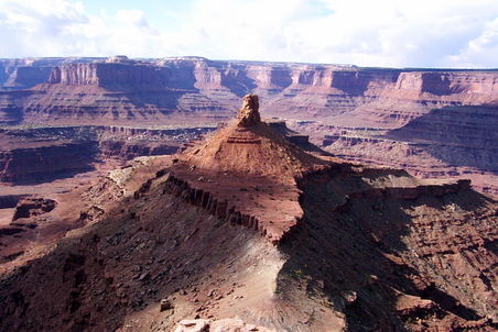
...mother nature pyramid surpasses man made pyramids in beauty...
Camping was $14 with hydro, no showers, and it was a bargain considering the view. Only 6 camp sites were occupied. Not bad considering that 200 000 visitors come annually. I woke up at night trying to catch my breath and to keep warm. We were camping at 6000' and the temperature had dropped below freezing. Dead Horse Point is a strange name. According to one legend, cowboys used to round up mustangs here and sometimes for kicks would run a mustang off the cliffs, watching it fall 2000'.
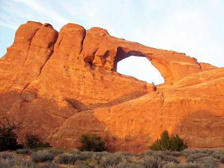
...Big Bridge in Arches. Notice two hikers standing in the hole...
Arches: I have to take back my words describing beauty of the Dead Horse Point. It was nothing compared to the spectacular scenery that we saw at the Arches National Park. Instead of canyons there were sandstone towers, arches, figurines, monuments, walls of vertical ribs rising over the broken ground. Red, White, Grey and Green colors, rocks of different shapes, some defying the gravity, some close, others just a silhouette on the horizon.
Water and wind is continuously carving holes in sand stone, creating arches, bridges, windows and much more. I recalled seeing photos of sculptures on calendars, but pictures cannot describe it. We spent three days there and only as we were leaving one realized how much was there to see.
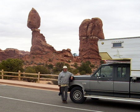
...Balanced Rock...
Moab was a town close to The Arches. I cannot imagine what it looked like in the summer when more than 50 000 tourists in a month descended on the town, but in October it looked tranquil. The streets are wide, downtown is not saturated with strip malls and the scenery is unbelievable, red bluffs and cliffs surrounding the town.
Stores had names like a "Poison Spider bike shop" or a 'Lazy Lizard hostel". The latter place had the cheapest showers in town, $2 per body, no time limit [others charged $5]. I was unfortunate to pick a 'single valve' shower . The valve seemed to work only in two positions: freezing cold or scalding hot, regardless of manipulation. When I finished the shower,I was not sure whether I was suffering 1st degree burns or frostbites. Then accidentally, I hit the valve with my elbow and nice, warm water came out. Sue had a different experience. A woman came to the shower shack in her underwear, took it off, hanged it on a tree and went in naked, followed by a strong smell of marijuana.
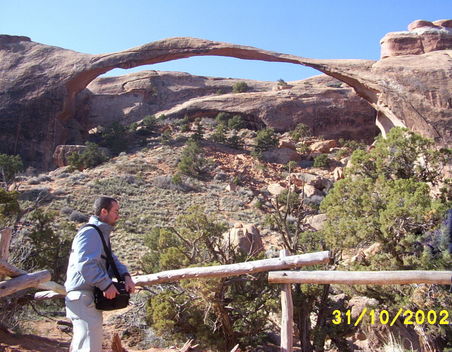
...The Thin Arch Bridge defied gravity until four years ago. Now only pictures remind...
We decided to visit the Grand Canyon. It was off season and most of the five million annual visitors to the park would be gone. On the radio we were bombarded with the US mid term election crap. Negative, simple minded and stupid like it was composed by 8-graders. The only dirty laundry they didn't hang out was sex.The Grand Canyon was beyond description. Huge, wide, deep, gouged, red, grey, green. Hard to believe that a little sliver of water at the bottom called Colorado River could carve such gigantic ditch.
I went for a hike on the Bright Angel Trail. It drops 3000 feet in 4.5 miles. The trail, about 4' wide, is very steep, full of zig zags and switchbacks, all the way to the bottom. Going down,I met returning hikers, all kinds, some young, some old and very old. Some fit, some out of shape, huffing and puffing. A few looked like they would never make it back to the top.
I was enjoying the scenery at the end of the trail when a scrawny guy came running, out of breath. He stopped for twenty seconds, looked around and pulled out his camera. "Can you take my picture please?" he asked with strong accent. I did and asked him where was he from. "Czech Republic" Well, a countryman, but before I could say anything he continued " Excuse me I have to run, my uncle is waiting" and was gone. It would be interesting to hear "Scrawny" describing his twenty second view of the Grand Canyon to Czech friends at home.
The Canyon was crowded with tourists even in November but free buses shuttle people around the park. Can't imagine what it looks like in the summer. Campground was almost full, many people sleeping in tents. The most exciting view of the Grand Canyon was from the seat of IMAX theater, going down the river in a raft. The Colorado river becomes mighty, powerful, fast flowing, full of dangerous rapids.
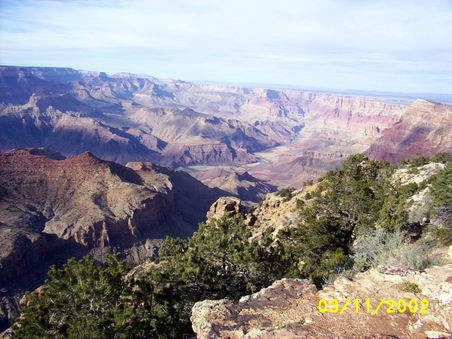
...The Grand Canyon was carved up by that little sliver of water at the bottom...
Arizona is the best state we have seen so far. Mountains dominate Northern Arizona and the highway climbs forever, Ponderosa pine forests hemming the road. Then the highway goes down in sharp curves and slowly the scenery has changed. We are in dry, hot, sandy, flat country with white cotton fields. Mexican music is starting to fill the air waves. We are passing tall palm trees and 30' high Saguaro Cacti. Highway signs read "blowing dust next 25 miles". We drive with the air conditioning on and are back into shorts and summer clothes. It is hot at night, a big change compared to freezing nights few days ago, time to ditch the temperamental camper furnace.
We were camping at the Patagonia Lake State Park, waiting for the Mexican car insurance to kick in. It is a man-made lake, only 265 acres, small by Canadian measures but big for a water impoverished Arizona. The campground was full of RV's and fishermen. In one section, powerboat macho cowboys in boats with over sized motors were running back and forth like maniacs.
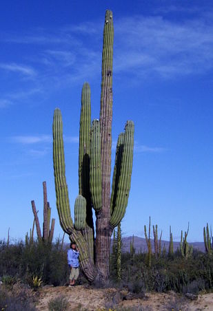
...Cactus that high? We grow them only in flowerpots...
Nogales is a city on Arizona-Sonora border and is recommended to novice travelers as an easy border crossing to Mexico. We were doing some last minute shopping when I realized we don't have a road map of Mexico. We tried Wal Mart, K-Mart, Sears, gas stations but couldn't find any. But stores were full of Mexicans shopping for TV's, bicycles, toys and cloths, packing them into beat up pick ups. We gave up on the map and were driving in the direction of the border.
There was a traffic jam on the street and police was directing traffic at the intersection. He waved me through but I squeezed into the next lane with less traffic. Damn it, it was not ordinary traffic, it was a parade! There were majorettes, flags, marching bands, firemen and soldiers, antique cars and WW II trucks. It was Veterans Day USA! Our truck was stuck, closing the parade with Canadian flag fluttering on the antenna. People were waving at us, believing we are part of the parade! We were lucky that spectators could not read our mind about their latest war.
Eventually we disengaged and road signs directed us to the border. We passed US Customs and drove through a big gate with sign MEXICO. I was looking for a parking spot but a policeman was waving us through, KEEP GOING!!,MOVE ON!!!
We were in Mexico, hemmed in traffic, on crowded street. Where is the Immigration, the customs, where we get the windshield sticker or insurance? Where are the crooked cops and drug traffickers? We were lost.....
| Start of journey: | January 2003 |
| Duration: | 5 years |
| End of journey: | January 2008 |
Mexico
Guatemala
Belize
