South by West- camping from Alaska to Nicaragua
6- Road to Hell
Shortcut to Basaseachi; Road to Hell; Night by Indians; Road of 1000 curves; Broken truck; Watch out for cows; Engineering marvel; Dog piss scare;
----------------------------------------------------------------
From Alamos we decided to go to Barranca de Cobre, the famous Copper Canyon. I talked to a camper from Idaho who just came from there. "It is a long way. However, there is a 150 miles shortcut through Obregon," he said. "but the road has many curves. You can make it, that guy couldn't", he pointed at 5th wheel. "You should stop at the Basaseachi waterfall, the highest in Mexico."
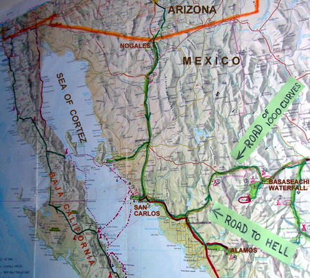
Well, we made it to the waterfall, but what he told us was a great understatement. I called the short cut "The road to Hell". A few miles after Obregon the road headed for the mountains and changed into a narrow road, barely wide enough for two vehicles to pass. There was not any straight section, only continuation of sharp, hairpin curves. The road climbed up for miles and then down for miles, from one mountain ridge to another.
I kept shifting from 2nd to 3rd to 4th gear and back to 2nd every 30-60 seconds. Many times I got tired of shifting and just kept going in 2nd gear, good for climbing and breaking. There was practically no place to pull over and if you could find one, it was full of garbage, rocks and pieces of wrecked cars.
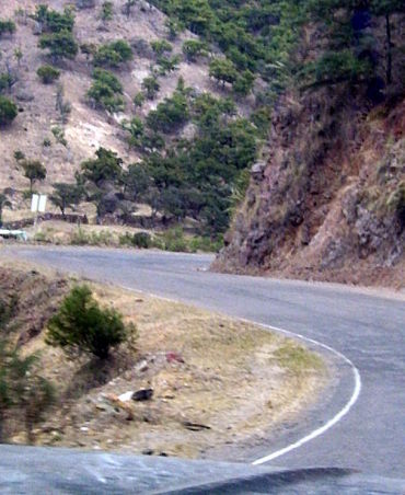
...behind this curve is another and another and many, many more...
I got used to being alone on the road and was startled when out of the blue there might be a car right behind, trying to pass or an eighteen wheeler coming out of a curve. Sometimes, when I saw a truck on the road above, I would stop and wait few minutes until he passed.
Once there was a broken down truck, wheels blocked by rocks, in the middle of the road, just before a curve. I managed to inch around, but how did that big eighteen wheeler we met few minutes ago got around it? Watch out for a small pile of rocks or few branches on the side of the road! It means there is a broken car ahead.
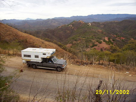
...we will be driving over all these mountain ridges and valleys...
Watch out for cows! Some were rambling along the road, others standing on cliffs above the road, munching, few dead in the ditch. Did they belong to anybody? There were no signs of habitation, only occasional road sign pointing to a dirt road. We drove for five hours and covered only 160 km on winding road. If it wasn't for meeting few cars and trucks I would be convinced that we were lost, driving to nowhere, on the Road to Hell.
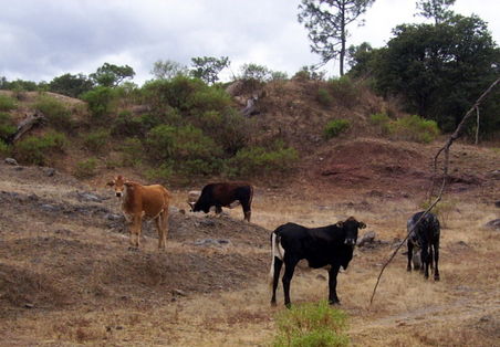
...Do not drive at night! The pavement is warm and cows like to hang around it...
It was getting dark when we arrived to a village not marked on the map. There was a house beside the road with a big tree and space to park. An old Indian woman was cooking something on a fire. I pulled over and asked if it is OK to park there overnight. She answered something in Indian language. Was it yes or no? Well, it was too late so we took our chance. Then a man rode in on a horse, Sue gave him 50 pesos and we were set for the night.
Next day we continued driving until we met highway #16 from Hermosillo to Chihuahua. This was the road we bypassed via the "Road to Hell", a good, paved, two lane highway.
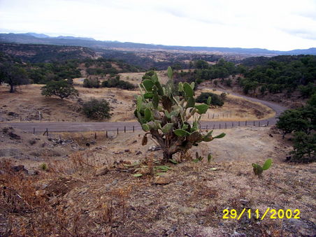
...Road of Thousand Curves has thousands scenic views...
Well, we have made it, I thought, it is only few hours to Basaseachi. But I was wrong, there were more curves, many more, not as sharp and continuous as before but endless with occasional "Curva peligrosa" sign [dangerous curve]. Were there thousand curves, two thousand or five hundred? I lost count but would swear that there was not 500 yards of straight road for 190 km.
The road itself was an engineering marvel. In Canada there would be tunnels and bridges, cuts and fills. It would cost a fortune to build such road. Here it just followed contours of the ridge. You can see the road for miles ahead, climbing over one ridge after another. I named it "The Road of Thousand Curves"
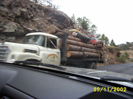
...Old, grossly overloaded trucks slowly crawls uphill, belching smoke...
There were very few crosses along this road. That is because there are two kinds of drivers in Mexico: the good ones and the dead ones. The later never made to The Road of Hell. Many trucks carrying logs were grossly overloaded, belching smoke, but drivers were waving and moving over to give room to this slow, hopeless, fearful Canadian driver.
A big truck was coming down the hill as I was taking pictures. Suddenly brakes were screeching, engine brake rumbling and the truck stopped in front of me. The driver got out. What happened? "Could you take my picture please?". Sure. I took his picture and promised to send it to him
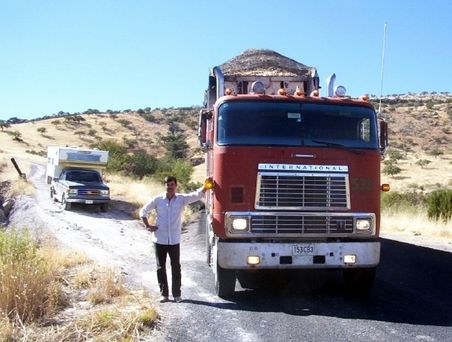
..."please take my pictures"...
We stopped for a coffee at a ramshackle restaurant. Coming back to the truck I checked the tires. Shit! A clear liquid was dripping from the hub of the rear wheel. "Something is leaking here, maybe the brake line" I yelled at Sue. I rubbed it on my fingers. It felt watery. Was something leaking from the camper? I could not see anything dripping. What was it?
I was going to taste it when Sue called. "It must be the dog. There is a dog is behind the truck." My fingers froze two inches before my lips. Sure enough, there was a dog slowly walking away, looking at me. I was horrified. I almost licked dog piss off my finger!!
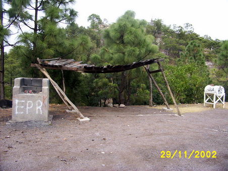
...This Rest stop looks clean because the garbage was pushed over the edge. The water barrel is empty. What is that wobbly structure?...
| Start of journey: | January 2003 |
| Duration: | 5 years |
| End of journey: | January 2008 |
Mexico
Guatemala
Belize
